


Ice conditions detected by satellites
Ice conditions detected by satellites
During my time at the Daneborg research station, I conducted a geophysical characterization of the snow and sea ice as a tool for validating both optical and microwave satellite sensors.
The satellite optical sensor is providing photo-like data, while the microwave sensor emit wave length which can penetrate through clouds and also can work during the long, dark arctic winter.
Changes from atmospheric forcing at the sea ice surface, such as solar heating, are manifested as physical property changes, like snow melt, surface flooding and melt pond formation. These changes can be detected using satellite active microwave data, where changes in the surface can be detected.
Data collection from snow pits and ice cores allows us to understand the physical processes that are occurring at the ocean-sea ice-atmosphere (OSA) interface, which ultimately will lead to a better understanding of how satellites can see the seasonal transitions of snow and ice cover.
Kerri Warner, University of Manitoba
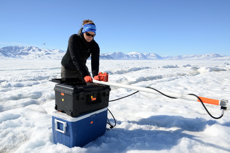
Kerri Warner measuring incoming light and reflection of light from the ice surface to calibrate satellite images taken at the same location.